North America


Geo Week Relocates to Salt Lake City for 2027
Leading Geospatial Event Sets Sights on Utah’s Fast-Growing Geospatial Tech Hub DENVER, CO – February 18, 2026 – Geo Week, North America’s premier geospatial and mapping technology event, announced that...Read More
When Industry is Cut Off at the Root: The Commercial UAS Industry After the FCC Covered List
By: Charlton Evans, Autonomy Global Ambassador – Certification Author’s Note This article was drafted in early January 2026, immediately following the FCC’s expansion of its Covered List to all foreign...Read More

Geo Week 2026 Opens Today with Record-Breaking Exhibit Hall
Event Brings Together Thousands of Geospatial Professionals for Unparalleled Collaboration and Industry Advancement DENVER, CO – February 16, 2026 – Geo Week 2026 opens today with the largest exhibit floor...Read More
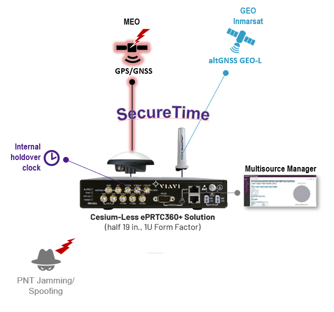
VIAVI Launches Cesium-less ePRTC360+ Enhanced Primary Reference Time Clock as Alternative to Cesium-Accuracy Holdover Clock
Only alternative to Cesium clocks to meet ITU-T G.8272.1 drift standard, with no time limit and at a fraction of the cost Chandler, Ariz., February 17, 2026 – VIAVI Solutions Inc. (VIAVI)...Read More
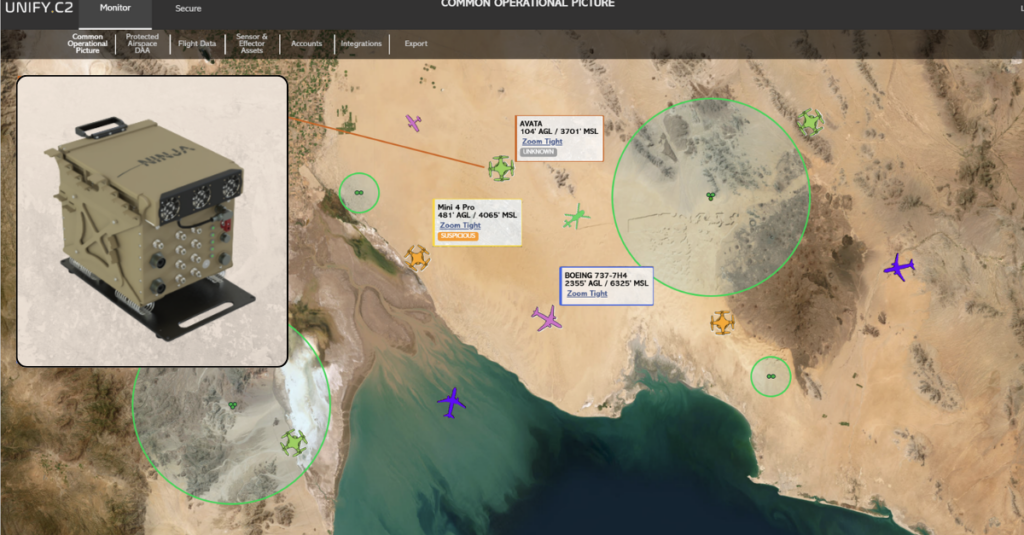
UNIFY.C2 and Black River Systems Announce Strategic Partnership to Integrate Ninja™ C-UAS Capabilities into Unified Airspace C2 Platform
Partnership unites Ninja™ C-UAS sensing and mitigation with UNIFY.C2 real-time fusion to deliver mission-ready airspace security for defense and gov’t operators Dallas, TX — February 17, 2026 — UNIFY.C2, the next-generation...Read More

Airspace Awareness Elevated: MatrixSpace’s New AI Platform and Fusion 360 Radar System
By: Dawn Zoldi MatrixSpace has just done something many airspace awareness vendors promise, but rarely deliver. It turned radar from a point sensor into the centerpiece of a multi-sensor, AI-native...Read More
Geo Week 2026: Emesent Launches the Emesent GX1, an All-in-One SLAM LiDAR, RTK and 360° Imagery Scanner
Industry first: GX1 delivers independently validated 5-10mm global accuracy, providing surveyors, AEC sector with long-awaited mobile scanning speed and survey-grade accuracy they can prove DENVER, 16 February 2026 ―Today at Geo Week, Emesent, a global leader in autonomous mapping technology, launches the Emesent GX1, the world’s most accurate integrated Simultaneous Localization and Mapping (SLAM) and Real-Time Kinematic...Read More
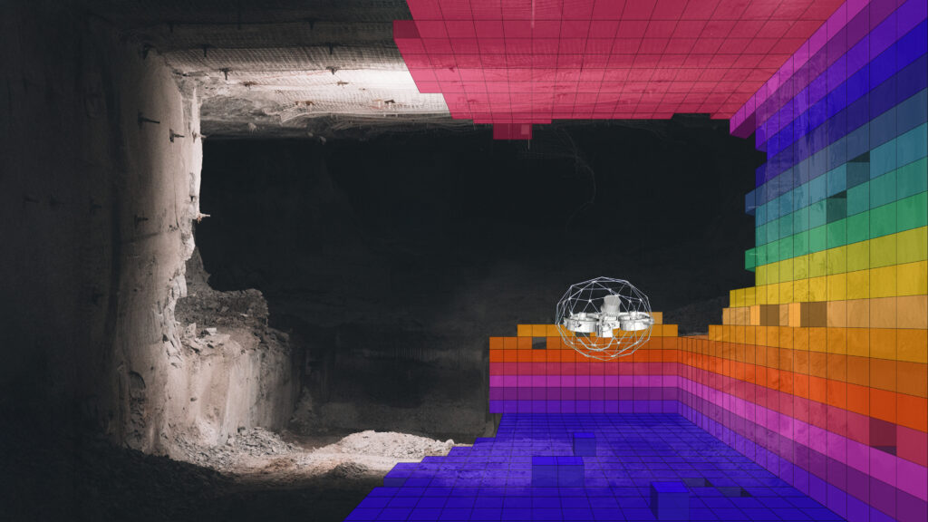
Flying Further, Seeing More: Automation Elevates Remote Drone Inspections
By: Dawn Zoldi Remote drone inspections, especially in tight, GPS‑denied spaces, used to depend entirely on pilot skill and nerves of steel. Today, automation has changed what they look like....Read More
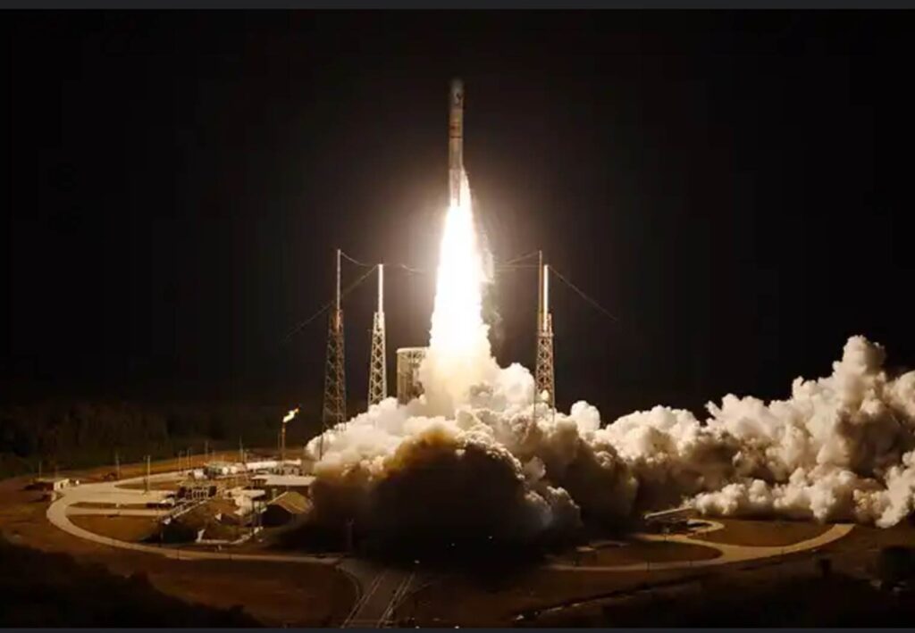
U. S. Space Force’s Space Systems Command and United Launch Alliance successfully launch USSF-87 mission aboard a Vulcan Rocket
Summary: The U.S. Space Force and United Launch Alliance (ULA) launch team successfully launched the USSF-87 mission from Cape Canaveral Space Force Station, Florida using a ULA Vulcan Centaur for this...Read More

VICTUS Builds Autonomy That Survives In A Contested World
By: Dawn Zoldi In autonomy, contested environments have moved from exception to baseline. VICTUS founder and CEO Jesse Hamel built his company, and its entire software architecture, to address this...Read More